 Pembrokeshire Maps
A selection of sketch maps showing regions within Pembrokeshire. Includes key towns and major roads, Pembrokeshire Coast National Park boundaries and Postcode Districts.
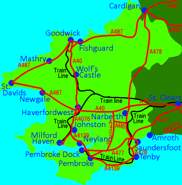
Map of Pembrokeshire Trunk Roads
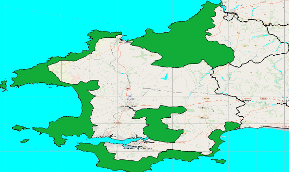
Map showing Pembrokeshire National Park
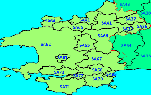
Map showing Postcode District in Pembrokeshire
Map showing Pembrokeshire National Park
Map showing Postcode District in Pembrokeshire
These maps include data from OpenStreenMap, data.gov.uk and DigitalDan.
DigitalDan.co.uk